

Photograph by Devyn Glista
If you’re wondering how far back our city’s battle with slip-sliding Columbia Parkway goes, check out this angry Cincinnati Enquirer editorial from 1969: “We have impatiently waited and endured the discomforts and dangers of this road, and will be exceedingly rejoiced when the work is completed.” Wait, did I say 1969? That’s from 1869, the year the Red Stockings turned pro.
Yes, Cincinnati has been tormented by Columbia Parkway across a 150-year love/hate relationship pockmarked with countless ruptures, repairs, and repeats. Some of the most catastrophic landslides along its eight-mile length occurred during the very attempts to cure its never-ending problems. And yet most people would agree that the creation and expansion of Cincinnati’s first modern thoroughfare has been worth the headaches. We should applaud our ancestors’ persistence in getting this eternal pain-in-the-ass road built.
The origin story of Columbia Parkway could be called A Street With No Name, but the more accurate title is A Name With No Street. Maps from around 1870 show only some dotted lines sprinkled between isolated stumps of roads, with each dotted line labeled “Columbia Avenue,” referring to Columbia-Tusculum, a then-suburban destination for many Cincinnatians heading east from downtown. Some day, it was hoped, travelers would glide past Kemper Lane and Torrence Road to arrive at Crawfish Road (today’s Delta Avenue). Finally, East Enders would enjoy a continuous, straight, wide, paved, level, and geologically stable route. Nobody realized at the time what it would take to accomplish all six of those objectives. Especially that last one.
Transforming the dotted lines into a solid street took way too long, for reasons that may sound familiar: City government fought turf wars with county government, while both got elbowed by local business interests (see: The Banks). Railroads profited from their exclusive lines along Eastern Avenue (today’s Riverside Drive) and were accused of paying off city officials for inaction. Ya think? It took almost 20 years, but by the 1890s Columbia Avenue was completed. It was here to stay. Unfortunately, it refused to stay still.
Landslides from the avenue’s first decade have pretty grim descriptions: “Great fissures have opened in the hillside.” “Trees that lined the walk can now be seen 15 or 20 feet further down the hill.” “The residence’s chimney leans toward the river like a cornstalk bending in the wind.” Paging Elton John.
Thus began Cincinnati’s tradition of putting up with the road’s random tantrums in exchange for comfortable travel between the East End and downtown. It was a tolerable, if uneasy, bargain, though it didn’t last very long. Columbia Avenue had been built for a 19th-century world of horses, buggies, and pedestrians (a boardwalk once ran along it), but soon enough the automobile would completely overwhelm that world. By the 1920s, Columbia Avenue might as well have gone back to dotted lines. Something had to be done.
Meanwhile, another corridor was quietly forming right where Columbia Avenue ended at Crawfish/Delta. It bent around the future Alms Park and out to Linwood, where the old Eastern Avenue extended to Beechmont Avenue and Wooster Pike. Hey, everybody, we could connect all of those roads together! And we could make them all much, much wider by dragging away more dirt than the hillsides can possibly stand! And then we could give all eight miles a glorious new name: Columbia Parkway. Gentlemen, start your taxes!
Columbia Avenue 2.0 began construction in 1929. As before, the project included years of arguing and delays, for reasons that may sound familiar: City government fought turf wars with county government, while both got elbowed by local business interests (see: the Cincinnati subway). At one point there were 18 competing plans. Somehow one was chosen, but, just as work began, it almost ended. A major protest had been suddenly launched by a powerful constituent who was in no mood to negotiate: Mother Nature.
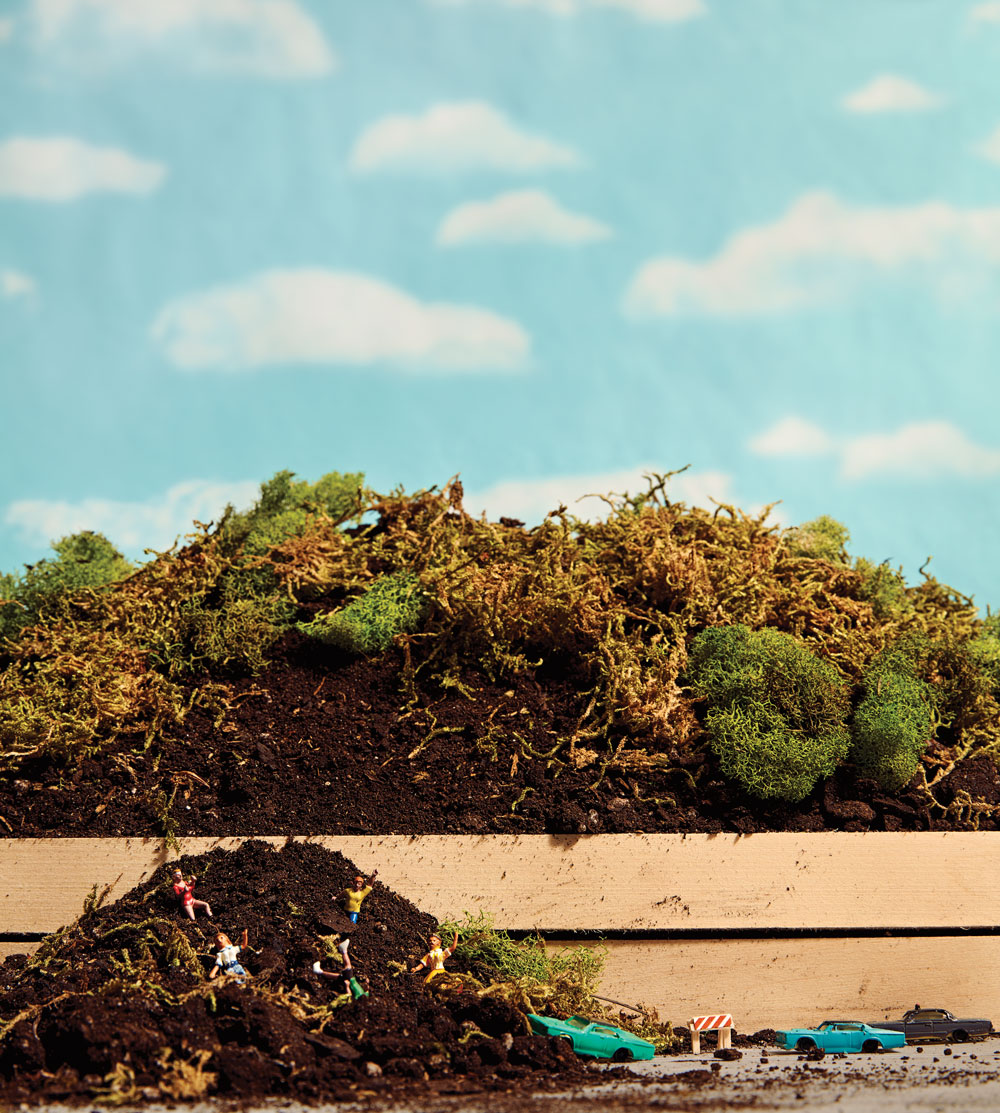
The landslide of April 10, 1930, was nothing like the ones you and I joke about today. A pile of dirt didn’t just tumble onto the road. What tumbled was the road itself, an almost quarter-mile stretch between Kemper and Torrence, cracking open like a lightning-fast ground fracture in a Road Runner cartoon and dropping several feet. All work stopped. The crew had been using a popular technique known as “cut and fill,” slicing away clay from the north side of the road and packing it along the south side, creating a wider path. The method went against the advice of geologists who’d warned against screwing around with the hillside at all. In their published study, they described the area’s soft clays as “treacherous foundations for buildings erected on them, or roadways constructed on them.” Did the geologists feel frustrated at being ignored? Or maybe vindicated? Neither. They were all dead. Their study was from 1873 and had been forgotten, because no one had Google.
Plans changed, super-deep foundations were dug, money somehow became available (thanks, Great Depression!), and work continued. As the road neared completion, the weighty issue of its name became a thing. Parkway? Boulevard? Thoroughfare? The city chose “Parkway,” except for one little section. A last-minute city ordinance was passed to give a separate name to a short ramp. Why? Thanks for asking: The ramp, leading out from downtown, was surrounded by large buildings owned by large businesses, with large roofs that had rented out large billboards for large dollars. By law, a parkway was prohibited from displaying billboards, so the ramp received its own special name: “Columbia Viaduct.” Paging the Marx Brothers.
When Columbia Parkway/Viaduct/Whatever opened in 1938, other problems immediately became apparent. For instance, today where you see a Martin Drive exit ramp to Mt. Adams, nobody saw anything, except constant backups. Right there, precisely where all of downtown’s eastbound traffic merged, anyone heading to Mt. Adams had to turn left without a dedicated turn lane. Officials took about 20 years getting the Martin Drive ramp built, because—all together now—city government fought turf wars with county government, while both got elbowed by local business interests (see: the concert venue at The Banks). There were also delays from eminent domain property seizures (see: FC Cincinnati’s stadium). I haven’t even mentioned state and federal departments gumming up the entire project (see: your water bill).
More ramps and tunnels were considered, but never created, to address the twice-daily backups at Kemper Lane and at the Taft/Torrence triangle. Ah, yes, Taft/Torrence—let us pause and reflect on that clown car of an intersection. For decades, Torrence forbid turning left to the eastbound Parkway and the Parkway forbid turning left to Taft. Creative U-turns created constant dangers. Such hilarity paled in comparison, though, to the intersection’s notorious “reversible lanes.” In the 1950s these deathtraps were all over town, but on Columbia Parkway they inspired extra-special automotive Hunger Games. Cincinnati bestowed this stretch of road with the highest allowable municipal speed limit of 45 miles per hour, perhaps because the County Coroner wasn’t busy enough. Reversible lanes were mercifully ended in the mid-1980s.
In recent decades, many of Columbia Parkway’s issues have been solved. Lanes are now wider and straighter. Walls go higher. The few remaining buildings have disappeared. Now, except for two almost-invisible driveways, the short commercial area in Columbia-Tusculum, and a death-defying offshoot called Audubon Street (see: my Dr. Know column from August 2017), Columbia Parkway is eight miles of wall-to-wall walls. That’s quite different from the original 1920s vision for this road: a continuous boulevard that would also be world-famous for its showcase panorama of our beautiful river.
Creating a lovely view was the original rationale for evicting every person and demolishing every structure along the south side. Descriptions from the early days suggest that, for a while, the ride really was quite beautiful. Plans had even been made for creating areas where you could pull over and enjoy the landscape. Imagine that: a parkway with parks. Today we’ve achieved the continuous boulevard, but our world-famous showcase panorama is mostly gone.
And the landslides have never stopped. City officials often describe them as something we just have to occasionally deal with and get used to, like the cat throwing up. This year’s uptick of incidents has spurred emergency action, but instability might be Columbia Parkway’s default mode forever.
Those who use the road know how hard it can be to live with. Living without it isn’t much of an option, either. Cincinnati may spend another 150 years scrambling to keep the mud away when the hillside rumbles yet again, which it will. Wait, what’s that noise? It’s those geologists from 1873, still laughing.

Facebook Comments