



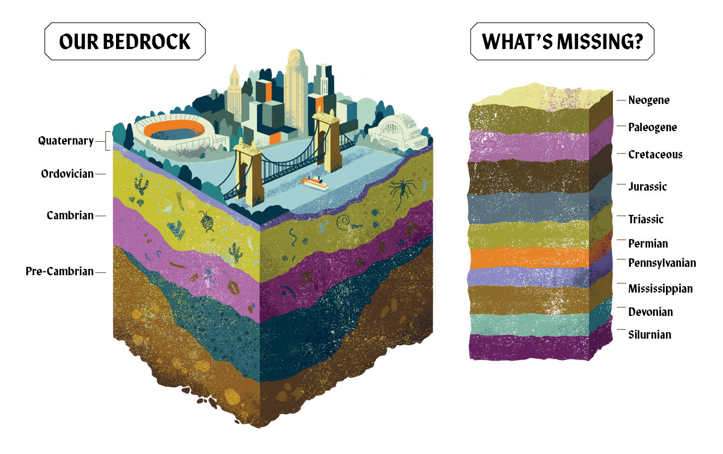
Illustration by Sandra Rilova
Between 1. 5 and 2 billion years ago, tectonic plates collided to form the primordial core of North America. This cataclysm created mountains that eroded into rifts formed by the stretching and cooling of the Earth’s crust. Our geological basement was poured.
This being Ohio, the basement flooded. We lay beneath a shallow “epicontinental sea, basically a sea on a continent,” the likes of which doesn’t really exist anywhere on Earth today, says Cincinnati Museum Center Curator of Invertebrate Paleontology Brenda Hunda. During this period, called the late Ordovician, an island chain collided with the eastern rim of proto-North America, raising more mountains. With terrestrial plants yet to arrive on the scene, the landscape was highly erosive, Hunda says.
Thanks to the magnetic signatures of minerals trapped in rocks at their formation, scientists can track continental drift across hundreds of millions of years. At the time of our inundation, Ohio was 10 degrees or so south of the equator. While we were enjoying a balmy bath, multicellular marine life appeared, creating a sediment of tiny fossils. Put limestone under a microscope, Hunda says, and you’ll see seashells. Underwater mudslides blanketed those limestone layers with eroded mountain clay. This layering action baked the bright gâteau of rock layers visible in our road cuts, outcrops, and creek beds. Buildup of colluvium—a mixture of the erosion of shale and limestone plus vegetation and other debris—on hill slopes becomes unstable when it rains. Hence our mudslides. Next time you’re detoured after heavy rain for a hillside collapse, blame your lateness on Ordovician mudslides.
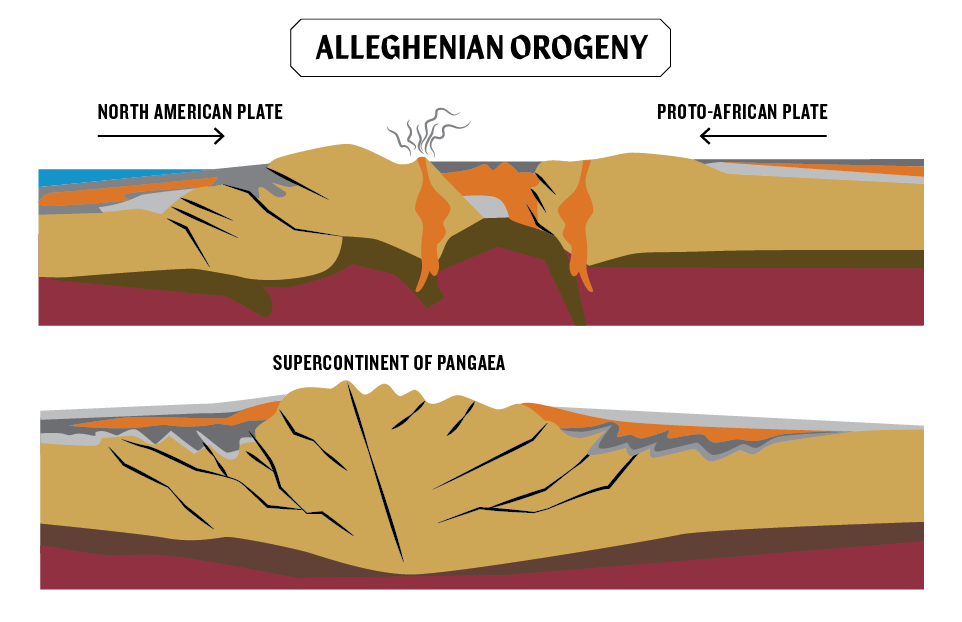
Illustration by Brittany Dexter, adapted from United States Geological Survey Illustration
Trilobites appeared and sponges were dominant in the Cambrian period. Their emergence was upstaged in the following period, the Ordovician. The Great Ordovician Biodiversification Event, or GOBE, was perhaps the fastest evolutionary radiation of all time, Hunda says. She likens it to the leafing out of a tree in terms of multiplying complexity. “Life on this planet just exploded, to the point where there was a tripling of marine families and a doubling of marine orders,” she says. Look closely at our rocks, and the brachiopods and branching fans of the coral-like bryozoans that blossomed during the Ordovician period even look like trees.
The Ordovician seas also teemed with relatives of starfish and sea urchins called crinoids, plus straight- and coil-shelled cephalopods, predecessors to modern squids and nautiluses.
“When you pick up a rock in Cincinnati, you can find six, seven, eight different phyla on a single rock. You have amazing diversity. We’re not particularly famous for any one fossil group,” she says. “We’re more famous for the diversity of all of the fossil groups, for the sheer abundance and cornucopia of fossils here.”
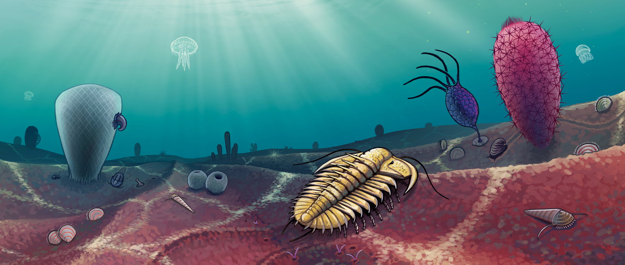
Illustration by Kyle Hartshorn
While a combination of fertile seas with layers of clay and limestone made our region “world famous as a fossil-bearing area,” University of Cincinnati Geosciences Professor Carl Brett, who has spent decades studying Paleozoic strata and ancient climate change, says it’s also “world class because of the flukes of tectonic fate that brought these rocks up to the surface, and those rocks were never subjected to really high temperatures.”
The biggest of those flukes is an upward curve in the earth’s crust on which Cincinnati is centered, the Cincinnati Arch. This immense structure resulted from more mountain building events, or Alleghanian orogenies, to our east, the same that raised the Appalachians which, before they eroded, were as giant and jagged as the Himalayas. The immense weight of those mountains pushed down on the earth’s crust, creating a basin, Brett says. “As the crust is pushed down in one place, the plastic mantle underneath actually squeezes outward and upward on the inner side of that basin. And that creates a gentle fold or forebulge. This, then, is the beginnings of an arch.”
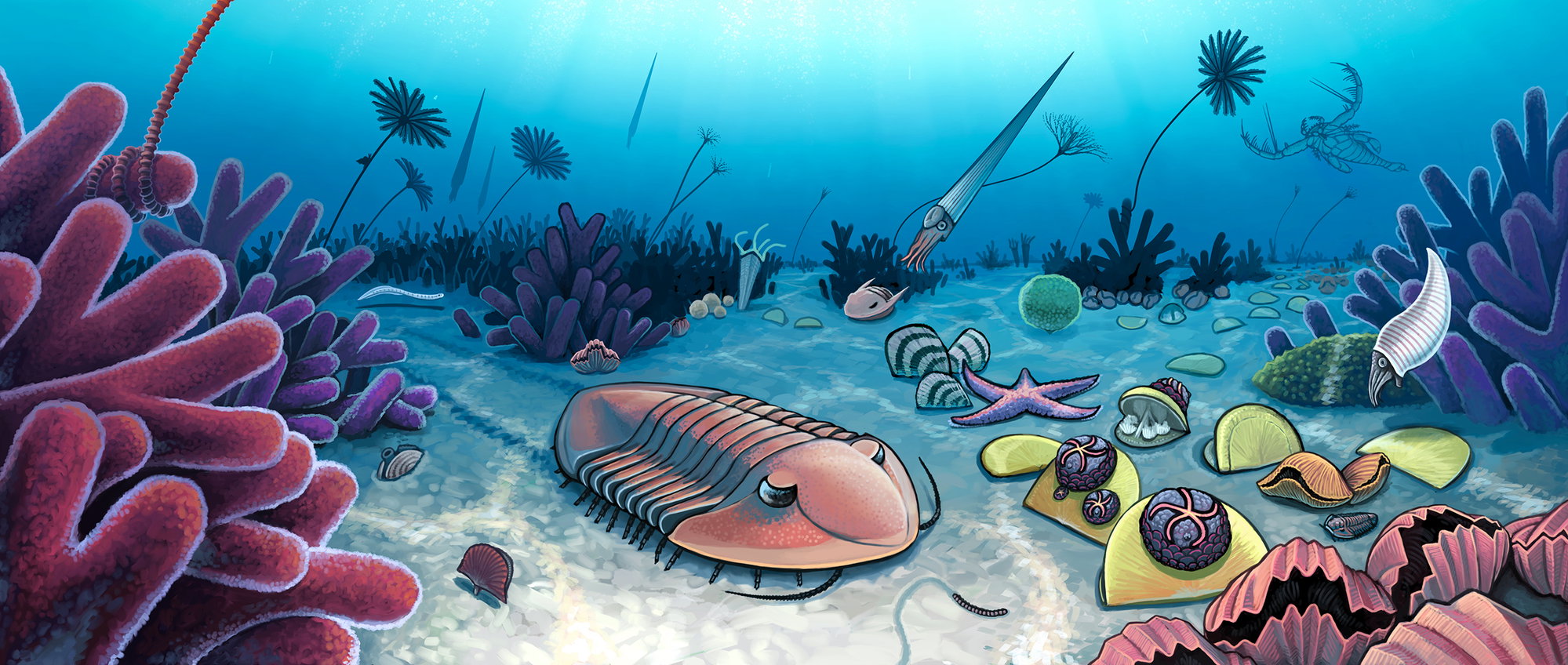
Illustration by Kyle Hartshorn
The Cincinnati Arch is subtle, hidden in plain sight. Some say its curvature near the center is less than that of the Earth itself, Brett says. Which makes its 1838 discovery by Cincinnati scientist and all-around Renaissance guy John Locke, whose CV includes inventing a magnetic clock, founding the Cincinnati Women’s Academy, and exhibiting the first photograph in America, all the more impressive.
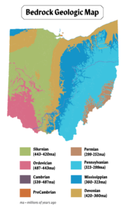
Illustration by Brittany Dexter, adapted from Ohio Department of Natural Resources Bedrock Geological Map of Ohio
Locke was assisting Ohio’s first geological survey when “he noticed that there was a slight change in the dip of the rocks, first going to the east and then as you cross back to the west. And so, by very careful measurement, he was able to show that there was this very gentle bowing of the strata in this area,” Brett says. Over eons, glaciers and rivers eroded the top of this arch, exposing the oldest rocks at its center and the youngest rocks around the edges. Like cutting the top off an onion. And voilà! A paleontologists’ paradise is (very slowly) born.
The sea life pressed into the folds of the Cincinnati Arch has made it a rich source of useful materials. Of great interest to early speculators were the oil and natural gas reserves it harbors to our north. But you can’t put a price on reservoirs of wonder. In some of its layers, Brett says, “you get beautiful snapshots of a sea bottom that was probably buried by a storm or, as I’ve argued, a tsunami-type deposit. Things were literally buried alive. So you get these spectacular layers of detail where you can see the trilobites reacting to the disturbances, layers where they’re caught rolling into balls.”
New technology opens new treasure troves in these layers from deep time.
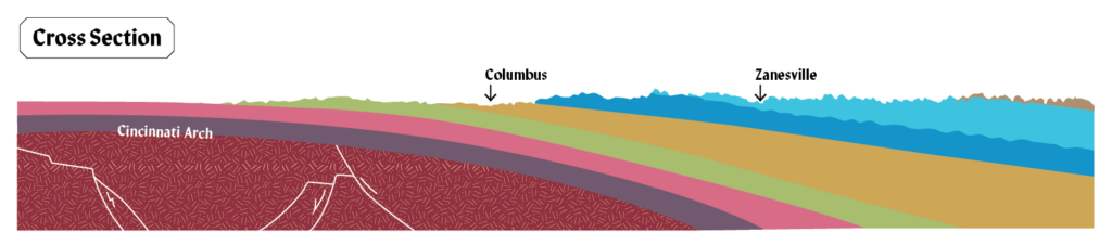
Illustration by Brittany Dexter, adapted from Ohio Department of Natural Resources Bedrock Geological Map of Ohio
“We have all these new technologies like Micro-CT [micro-computed tomography] scanning and synchrotrons,” Hunda says, “which are now being applied to paleo.” These allow scientists to image the interiors of rocks and fossils in three dimensions without breaking them apart, revealing previously invisible details. “I just sent a specimen to Australia to get bombarded by neutrons in order to image inside the rock,” she says. Such technological advances “allow us to see things differently, or to see more than what we’ve ever known. And with each new discovery, we’re pushing back what we know about life in the fossil record. And that could change the way we view the late Ordovician. So in the future, who knows?”
Our geologic basement, while often damp, is deep. The upper Ordovician rock layer alone, called the Cincinnatian Series, is between 800 and 1,000 feet below Ohio, Indiana, and Kentucky. Other layers run deeper still. Who knows what secrets lie yet to be revealed?